Geodesign & Environmental Resilience Webinar video
Network News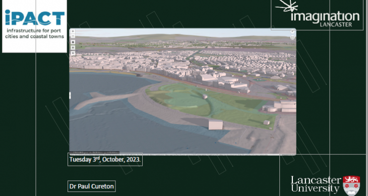
If you did not make it to the webinar on 3rd October or if you want to review the talk by Dr Paul Cureton, you can now watch this on YouTube. In this webinar Dr Cureton discussed the importance of maps as physical and sociological artefacts as well as being representations of models and digital worlds.
“The dynamic nature of maps and the agency that map artefacts have can be an important device to set out physical and sociological transformations in the environment.”
Geodesign is a framework and series of methods developed by Carl Steinitz for collaborative decision-making between built environment professionals and natural sciences using geographic information systems (GIS). The framework has been established for over twenty-five years and is pertinent to contemporary coastal challenges and multidisciplinary work for climate futuring (Hollstein, 2019). This presentation presents a state of the art of Geodesign. It offers a new delivery mechanism for Geodesign using UX cards as a design tool for non-traditional audiences and an applied case study to demonstrate its relevance in complex coastal environments for resilience.