iPACT webinar 9 – Wave overtopping hazard – from observation to prediction

Wave overtopping hazard – from observation to prediction
Prof Jenny Brown National Oceanography Centre
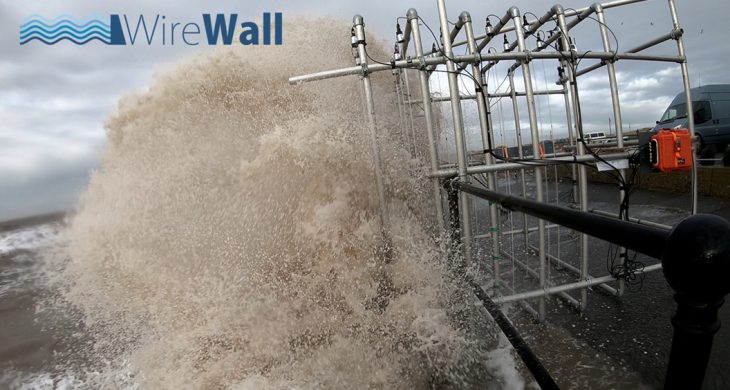
Defending the coast from flooding is a challenging job, especially with the uncertainty of climate change and rising sea level. To improve coastal flood hazard forecasts and how our coastal schemes are designed, we need to be able to observe the sea as it crashes against sea walls. A new prototype instrument to measure the volume and speed of waves as they spray, shoot and slop over a sea wall was engineered by the National Oceanography Centre in collaboration with HR Wallingford in 2018. To find out more take a look at the 4 min research clip https://www.youtube.com/watch?v=a5Y33SWdNU4 or the field deployment at Crosby near Liverpool. In 2021 the new system was deployed in Dawlish and Penzance, in collaboration with the University of Plymouth, to assess its performance in higher energy wave conditions and durability to longer deployment periods, up to a year. At the same time measurements of the beach level were collected to understand the influence of the beach on wave overtopping hazard. The specialist information from this system and computer modelling has allowed improved understanding of hazardous wave events at the three study sites to improve flood forecasting.
Prof Jenny Brown – Research interests
Shelf sea and coastal impact modelling: Application and development of nested modelling systems to simulate 3D wave-circulation interactions, the net sediment transport which they cause, leading to changing coastal morphology, and coastal flood hazard.
Coastal hazards monitoring: Development of new measurement systems that stream near real-time hazard information and provide data to calibrate/validate and develop predictive tools.